KABLOONAS

KABLOONAS
Burial of John Franklin. Author: me

KABLOONAS

Kabloonas is the way in which the Inuit who live in the north part of Canada call those who haven´t their same ascendency.

The first time i read this word was in the book "Fatal Passage" by Ken McGoogan, when, as the result of the conversations between John Rae and some inuit, and trying to find any evidence of the ill-fated Sir John Franklin Expedition, some of then mentioned that they watched how some kabloonas walked to die in the proximities of the river Great Fish.

I wish to publish this blog to order and share all those anecdotes that I´ve been finding in the arctic literature about arctic expeditions. My interest began more than 15 years ago reading a little book of my brother about north and south pole expeditions. I began reading almost all the bibliography about Antarctic expeditions and the superknown expeditions of Scott, Amundsen, Shackleton, etc. After I was captured by the Nansen, Nobile and Engineer Andree. But the most disturbing thing in that little book, full of pictures, was the two pages dedicated to the last Franklin expedition of the S.XIX, on that moment I thought that given the time on which this and others expeditions happened, few or any additional information could be obtained about it. I couldn´t imagine that after those two pages It would be a huge iceberg full of stories, unresolved misteries, anecdotes, etc. I believe that this iceberg, on the contrary than others, would continue growing instead melting.


sábado, 9 de junio de 2012

¿DONDE ESTÁN LAS OTRAS TUMBAS?/ WHERE ARE THE OTHER GRAVES?

Acabo de devorar, si, esa es la palabra adecuada, el fascinante libro "Frozen Time" de Owen Beattie y John Geiger en apenas tres días. Y de su lectura vuelve a surgirme una cuestión que otras veces ya me había planteado (y que otros muchos se han planteado anteriormente), ¿Donde están enterrados los 8 oficiales y 13 hombres restantes que se mencionan en la nota del 25 de abril de 1848? ¿y Franklin?.
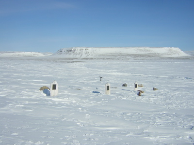
Un oficial y dos hombres fueron enterrados en la isla Beechey,  pero ¿y el resto de aquellos que se mencionan en la nota?  "...El total de pérdidas por muerte en la expedición ha sido hasta la fecha de 9 oficiales y 15 hombres". Puede que algunos murieran durante la travesía desde la isla de Beechey por el estrecho de Peel, en cuyo caso podrían haber sido arrojados al mar o enterrados en el hielo durante el invierno de 1846-47 cuando todavía se encontraban bastante al norte del cabo Félix.

Es muy posible que la gran mayoría de ellos muriera en el transcurso de los dos inviernos pasados en las proximidades de la tierra del rey Guillermo y durante la deriva de los barcos entre el punto donde quedaron atrapados en el invierno de 1847 hacia el punto en el cual fueron abandonados la primavera de 1848,.

Aunque no es probable que a muchos de ellos los enterraran en tierra firme, puesto que si trazamos una línea recta  entre ambos puntos, la distancia más corta sería de unas 6 millas naúticas hacia la costa de la isla. Demasiada larga quizás para llevar a los cadáveres desde los barcos hasta la costa para ser enterrados. No obstante hay testimonios Inuit que aseguran que Franklin si fue enterrado en la Isla.

Frankilin murió en junio de1847, cuando posiblemente se encontraban en una posición relativamente más cercana al cabo Félix que la del invierno previo. Por ello es posible que aquellos que murieran a partir de ese verano y hasta el abandono de los barcos si fuesen enterrados en tierra firme, pero...¿donde? sus tumbas si existen, no han sido localizadas todavía, al igual que aquella de Franklin, supuestamente bajo una losa de cemento fabricado in situ y bajo un mástil con una bandera. Quizás se encuentren en una posición mas al norte de la tumba, supuestamente de Irving cerca del Punto Victoria.

Leyendo el increible blog "Visions of the North" del Dr. Rusell Potter he localizado el Mapa de los restos y posible trayectoria de la expedición de Franklin  en el 2009, fue dibujado por R.T Gould y que el encontró disponible en el año 2009 A COLOR en la Biblioteca y archivo de Canada. No hay rastro en este mapa que indique la posible presencia de estas supuestas tumbas perdidas. 


I´ve just devoured..., yes, that is the correct word, the fascinating book "Frozen in time" by Owen Beattie and John Geiger in just three days. And from its Reading arose again a question that other times i ´ve already asked at myself (and that others have asked before), Where are the remained 8 officers and 13 men mentioned in the note of the 25 of april of 1848 buried?.

An officer and two men were buried in the Beechey Island, but, what happen with the rest of those which are mentioned in the note?...”The total loss by deaths in the expedition has been to this date 9 officers and 15 men.” And Franklin himself?.

It´s possible that some of them would die during the traverse from the Beechey Island along the Peel Sound, in that case, they might be thrown to the sea or buried into the ice during the 1846-47 winter, when they were still further north of Cape Felix.

It´s very likely that most of them would die during the two winters passed close to the shores of the King William Island and meanwhile the derive of the ships between the point where they get trapped into the ice in the 1846-47 winter to the point in which they were abandoned in the spring of 1848 (5 miles NNW the cairn).

Although is not likely that they buried many of them in firm land. If we trace a straight line between both points, the shortest distance to the shores of the island would be 6 nautical miles . Perhaps too far to carry the corpses from the ships to the coastline to be buried. However, there are testimonies of the Inuit assuring Franklin was buried in the Island.

Franklin died in june of 1847, while they were likely in a relatively close position to the cape Félix than the previous winter.

Because that, it ´s possible that those who died from this summer to the moment in which the ships were abandoned, would be buried on firm land . But, Where?.

Their graves, if they exist, haven´t been located yet. The same occurs with Franklin grave, supposedly under a slab of concrete made “in situ”  and under a mast with a flag. Perhaps this graves are located further north from the grave of Irving in Victory Point.

Reading the incredible blog called "Visions of the North" of the Dr. Russel Potter I ´ve located the map of the relics and the likely trail of the Franklin expedition. It was drawn by R.T.Gould and it is available ON COLOUR since 2009, in the Library and archive of Canada. There is no trace in this map which shows the existence of this supposed lost graves.

miércoles, 6 de junio de 2012

EL TIO DE JOHN HEPBURN/ THE JOHN HEPBURN UNCLE

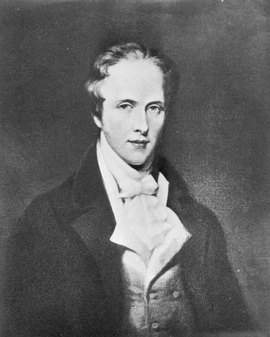
Investigando un poco por la red he localizado al que podría ser el tío de John Hepburn mencionado tan misteriosamente como el conde de S. en el diario de Joseph Rene Bellot escrito durante la expedición en busca de John Franklin de 1851 al mando de William Kennedy.

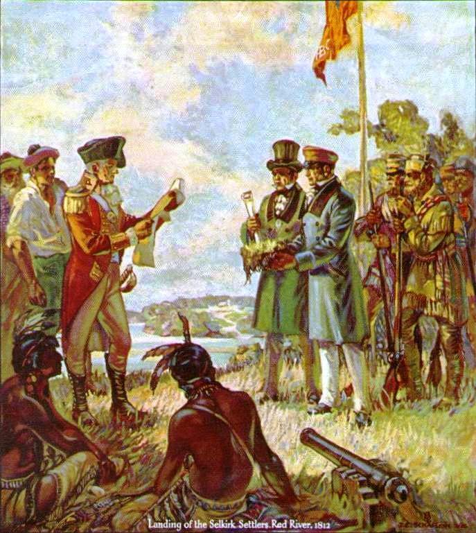
Según parece el 5º conde de Selkirk, Thomas Douglas compró junto con Alexander McKenzie parte de las acciones de la Hudson Bay Company. Thomas murió en 1820, por tanto dado que la entrada del diario de Joseph René data del año 1851, no pudo ser Thomas el tio al que Joseph hace referencia.

Le sucedió Durban, James Douglas, su hijo, como 6º conde de Selkirk.  Probablemente este heredara de su padre la parte correspondiente de la compañía y de ahí la referencia de Joseph en su diario. Aunque la referencia del diario a la propiedad de las acciones corresponde al padre, la descripción del tio encaja con la de Thomas, como conde de Selkirk, como uno de los primeros en enviar allí (Canadá) emigrantes desde Escocia, y que probablemente Durban debió continuar. Además es probable que ambos tuviesen parte de la propiedad de la compañía.

Landing of the Selkirk Settlers Red River 1812

No obstante, no estoy seguro de esta afirmación y continúo tratando de identificar las identidades de su padre y de su tio.

Investigating a little in the web i´ve located who could be the uncle of John Hepburn mentioned so misteriously as the Earl of S. in the Joseph Rene Bellot Journal written during the searching of Franklin expedition of 1851 under the command of William Kennedy.


It seems that the 5th Earl of Earl of Selkirk, Thomas Douglas bought together with Alexander McKenzie part of the shares of the Hudson Bay Company. Thomas died in 1820, so, as the comment in the Joseph Rene journal dates from 1851, it couldn´tbe Thomas the uncle which Joseph was referering to.

Durban, James Douglas, his son, succeded him as the 6th Earl of Selkirk. Probably he inherited the corresponding part of the company and form there the reference of Joseph in his Journal. Though the journal reference about the propierty of the shares belongs his father, the uncle description fits well with that of Thomas, the earl of Selkirk, as one of the first in sending Scottish emigrants there (Canada) and that Durban must continue, is likely that both had part of the properties of the company.

However, i am not sure of this affirmation and i continue trying to identify their identities.

domingo, 3 de junio de 2012

ENCUENTRA A FRANKLIN TU MISMO/FIND FRANKLIN YOURSELF

Si, suena un poco raro, pero en fin, no os lo tomeis muy en serio.

¿Como podemos encontrar a John Franklin?, pues es muy simple, existe, aunque parezca mentira, un juego que permite dar con los principales restos de la expedición de Franklin escondidos en la nieve. La verdad es que nunca me habría imaginado que a nadie le diera por hacer algo semejante, pero aqui está:

Juego "Encuentra a Franklin"

Tanto tiempo buscando a John y mira..., aqui está. Disfrutadlo.

La página web tiene su gracia, echadle un vistazo: http://www.athropolis.com/index.htm

Yes, it sounds a little bit strange, but don´t take it very seriously.


How can we find John Franklin? Well, It is very simple, it exists, although it seems unlikely, a game which allows you to find the main relics of the Franklin Expedition hiden in the snow. I´d never really have imagined that anybody could think in such thing, but here you have it:


Game "Find Franklin"


So many time looking for John and look..., here it is. Enjoy it.


The web page is really funny, take a look inside: http://www.athropolis.com/index.htm

miércoles, 30 de mayo de 2012

DIRECTO DE LA FUENTE/RIGHT FROM THE SOURCE

Acabo de encontrar en el JOHN MURRAY ARCHIVE esta digitalización del cuaderno de notas de John Franklin que ségún parece escribió durante los peores momentos transcurridos en Fort Enterprise
 durante la expedición de 1819 para explorar la costa norte de Canada.
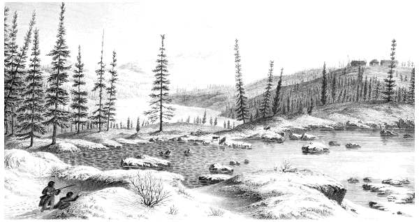
Fort Enterprise_Edward Finden (copy of a watercolour of George Back) Wikipedia

http://digital.nls.uk/jma/gallery/title.cfm?id=37&seq=25

La escritura demuestra sin lugar a dudas que fueron  momentos de una extrema dureza.  Pongo en primer lugar la última hoja, donde se dice el origen del documento, pero hay 25 ilegibles páginas del diario. Lo he intentado leer, pero personalmente no puedo entender nada o casi nada.

También figuran en esta web algunas de las acuarelas pintadas por George back. He elegido poner en primer lugar la de las cascadas Wilbeforce, la misma que Cory Trepanier, según comenté en un post anterior también ha pintado recientemente.

http://digital.nls.uk/jma/gallery/title.cfm?id=70&seq=22

I´ve just found this digitalized pictures of the notebook of John Franklin which seems to have been written during the worst moments passed in Fort Enterprise in the 1819 expedition to explore the north shores of Canada.

http://digital.nls.uk/jma/gallery/title.cfm?id=37&seq=25

The writting shows with any doubt the extremely hardness of the moment.  I put on first place the last page, where the origin of the document is mentioned by John Franklin but there are 25 illegible pages of the journal. I´ve tried to read it, but i can´t personally understand nothing or almost nothing.

It appears also in this same web page some of the watercolours painted by George Back. I´´ ve choosen putting on the first place that of the Wilbeforce waterfalls, the same that Cory Trepanier, as i said on a previous post has painted recently.

http://digital.nls.uk/jma/gallery/title.cfm?id=70&seq=22

martes, 29 de mayo de 2012

UN GUIÑO A JOHN RAE/ A WINK TO JOHN RAE

Ray Mears, es conocido entre otras cosas por los documentales de supervivencia que lleva haciendo desde 1994. En su documental "Northern Wilderness" de 2009, hace un cierto homenaje al explorador Escocés del siglo XIX  John Rae

Aunque breve, el documental es interesante, primero porque lanza al gran público la figura de este gran explorador y por otro, porque resalta las diferencias entre los métodos seguidos por Rae y aquellos métodos seguidos por otros exploradores que se adentraron en zonas inhóspitas en busca del paso del noroeste con estrategias totalmente distintas.

En las expediciones de principio del siglo XIX los oficiales apenas participaban en las tareas de procurar caza, pesca, etc., para ello llevaban guías y cazadores indios que les aprovisionaban, marineros Escoceses e
Ingleses que harían los porteos de los botes, interpretes esquimales para conseguir el apoyo de las tribus inuit locales, etc.. De esta manera, estos resultaban absolutamente imprescindibles para la subsistencia de todos los miembros de las expediciones y además, resultaban expediciones demasiado numerosas.

La estrategia de  John Rae, como dice Ray Mears, de no luchar contra los elementos sino con ellos y de ser en la mayor medida posible autosuficiente, resultaba una medida mas adecuada para un entorno en el que la caza y la pesca podía escasear y cuando las condiciones climáticas exigían estar a la altura de las circunstancias como solo los habitantes locales pueden estarlo. Las expediciones de Rae eran poco numerosas y todos los componentes en mayor o menor medida podían desenvolvérselas de forma autónoma.

Ray recorre en su incursión parte del norte de Canadá, y nos muestra en su documental a manufacturar raquetas de nieve, pescar en el hielo en alguno de los lagos Bear o Slave con técnicas esquimales y a fabricar un Iglú (¿quien no ha soñado nunca con hacer un Iglú?). Este documental es un breve recorrido por la naturaleza que nos trata de demostrar como, el entorno inhóspito en el transcurrieron tantas expediciones, ha dado también cobijo durante muchos años a muchas generaciones de seres humanos y a aquellos extranjeros que los han visitado que han tenido la prudencia y la paciencia de aprender las técnicas necesarias para desenvolverse en ese entorno. 

De alguna manera podríamos establecer una correspondencia entre John Rae y Amundsen por su tendencia a la adaptación al medio con las mejores técnicas disponibles de los habitantes de las regiones árticas y entre Franklin y a Scott por su visión, (por educación y cultura), mas militar y sensible....

Bueno solo es una reflexión, porque este tema daría mucho de que hablar.

Ray Mears, is known among other things by the survival documentaries that he have been doing from 1994. On his documentary “Northern Wilderness” of 2009, he pays some tribute to the Scottish explorer of the S. XIX John Rae.
Although brief, the documentary is interesting, On the one hand because it  throw to the general public  the character and image of this great explorer and on the other hand, because it highlight the differences between the methodology followed by Rae against the methods followed by other explorers of that time that entered this inhospitable areas searching the northwest passage.
In the expeditions at the beginning of the S.XIX the officers, hardly share the duty of hunting, fishing, etc. for that tasks, they were accompanied by Indian guides, hunters who support them, Scottish and English seaman that done the portages of the boats, Inuit interprets to get the support of the local Inuit tribes, etc. In this manner, their companions were absolutely essential to the survival of all the members of the expeditions, and besides, in fact, the expeditions result too crowded and hard to support.
The strategy of John Rae, as say Ray Mears, wasn´t working against the elements, but with them and being, on the most part of it, self-sufficient. It was a fitter measure for an environment on which the hunting and the fishing could be scarce and when the weather would need being prepared as only the local inhabitants can be. The Rae expeditions were little crowded and all of their components were able to develop well by themselves.
Ray goes across the north of Canada in his journey and show us in his documentary how to make snowshoes, fishing on the ice in the Bear or the Slave lake with Inuit technics and how to do an Igloo (Who never have dream on doing an Igloo?). This documentary is a short journey in the nature which demonstrate us how the inhospitable environment, on which so many explorations have passed, has also given shelter during a lot of years at a lot generations of human beings and to those foreigners which have visited them and who have had the precaution and the patience to learn the necessary technics to survive on this environment.
Somehow, we could establish some correspondence between John Rae and Amundsen for their trend to adapt themselves to the environment with the better available technics of the inhabitants of arctic regions, and between Franklin and Scott for their military and sensitive vision (perhaps by his education and culture).
Well, this is just a mental reflection, because this topic may have much to talk about.

miércoles, 23 de mayo de 2012

¿LA HERENCIA DE GEORGE BACK?/¿GEORGE BACK HERITAGE?

Pues parece que mis deseos se hicieron realidad. Resulta difícil encontrar fotos o registros de ningún tipo de la zona comprendida entre Fort Enterprise en las orillas del lago Winter y la costa norte de Norte América, pero parece que este hombre: Cory Trepanier, ha recorrido durante varios años estos lugares trayéndonos de vuelta un maravilloso registro gráfico.

Cory Trepanier ha plasmado en sus acuarelas de una manera realística e impresionante los paisajes desolados y fantásticos a la vez, de algunos de los lugares por donde transcurrió la expedición de John Franklin de 1819 y otros muchos lugares más.

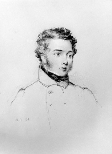
George Back_(Wikipedia)

Como hicieran en su momento los oficiales George Back y Robert Hood, Cory Trepanier, ha vuelto a dar vida a estos inaccesibles parajes y ha llevado de nuevo el arte a las costas más desoladas del Norte de América.

Además de las acuarelas hay numerosas fotografías de la entrada de Bathurst y de las cascadas Willbeforce
Cascadas Willbeforce_(wikipedia).
bautizadas por John Franklin y por las cuales la expedición pasó el 26 de agosto de 1821. Back y Hood también retrataron estas mismas cataratas aquel día hace 191 años.


Well, it seems that my wishes have become reality. It is hard to find photos or registers about the area between Fort Enterprise in the shores of Fort Enterprise and the north shore of North America but it seems that this man: Cory Trepanier, have travelled during several years this places bringing us a beautiful graphic record.
Cory Trepanier has put into his watercolors, on a realistic and impressive way, the desolated and at the same time fantastic landscapes, of some of the places crossed by the John Franklin Expedition in 1819 and a lot of other places.


Wilbeforce Falls by Cory Trepanier
http://www.daler-rowney.com/gallery/wilberforce-falls-study
The Falls of Wilbeforce
http://digital.nls.uk/jma/gallery/title.cfm?id=70&seq=22


As the officers George Back and Robert Hood would do that time, Cory Trepanier has again brought to the life at those inaccessible places and he has brought  again the art to the more desolated shores of North America.

Besides the watercolors there are a lot of photographs of the Bathurst inlet and the Willbeforce waterfalls, christened by John Franklin and where the espedition passed the 26 th of august in 1821. Back and Hood painted the same waterfall that day 191 years ago.

lunes, 21 de mayo de 2012

TIERRAS DE MISERIA/LANDS OF MISERY

Siempre he estado fascinado por el relato apasionante de John Franklin sobre la expedición a la costa norte de América de 1819. El relato es una fascinante descripción de un larguísimo viaje inmersos en plena naturaleza. El viaje transcurre ascendiendo ríos en canoas, atravesando enormes e infinitos lagos, haciendo innumerables porteos arrastrando las canoas y todo el equipo en los tramos más difíciles, pescando, cazando caribús, renos, perdices, etc.

Aquella expedición no tuvo desperdicio, desde las complicadas negociaciones del comandante Franklin con el jefe de la tribu india que les acompaña, Akaitchco, las negociaciones por obtener recursos de las dos compañías de comercio de pieles enfrentadas de la zona (la compañía del Noroeste y la compañía de la Bahía de Hudson), la rivalidad entre dos de los oficiales británicos (George Back y Robert Hood) por el amor de una india de belleza indescriptible (Green stockings) hasta el punto de que llegaron a retarse en duelo,  el asesinato de uno de ellos,. Robert Hood,  por uno de los participantes Canadiense de origen Iriquois, el abandono irremediable de varios compañeros Canadienses agotados en el camino cuando todos se encontraban al límite de sus fuerzas, etc.

Siempre he imaginado como podría ser aquel entorno en el cual la expedición transitaba, especialmente durante sus peores momentos, por las descripciones de George Back y del propio John Franklin el terreno denominado Barren Grounds. en español Tundra poco o nada tenía que ofrecer a los exploradores, tan solo y en latitudes ya lejanas de la costa aparecían pequeños grupos de árboles aislados que ofrecían cierto cobijo y la posibilidad de hacer fuego para calentarse. No olvidemos que desde mediados de agosto cuando todavía la expedición se encontraba en el estuario de Bathurst ya se empezaban a producir heladas y nevadas ocasionales, a partir de entonces comenzaba el otoño que rápidamente se convertiría en un crudo invierno, uno de los más duros de la época.

Concretamente he estado investigando en que lugar exacto acamparon el Dr. Richardson, John Hepburn y Robert Hood cuando este finalmente fue asesinado por Michel. Lamentablemente Google earth no ofrece imágenes detalladas de la zona en cuestión, y en función de la descripción y el mapa de Franklin (el cual encaja relativamente bien con las imágenes de satélite) parece que el lugar del campamento donde se produjo la tragedia podría distar unas 10 millas más o menos de los rápidos que habían cruzado dos días antes en dirección sur sur oeste (aunque es difícil de precisar porque Franklin menciona las primeros seis millas recorridas el día 5 de octubre, pero no la distancia recorrida el día 6 que debió ser considerablemente menor debido a la necesidad de hacer continuas paradas y a que el terreno debía ser bastante agreste. Considerando todo esto y midiendo la distancia de 10 millas me he aventurado a ubicar la zona del campamento aquí:


El punto rojo sería el lugar del campamento y la flecha el paso del rápido.

I´ve been always fascinated by the thrilling story of John Franklin about the expedition to the north America shores in 1819. The story is a fascinating description of a very long journey immersed in the very heart of nature.  The voyage pass surmounting rivers in canoes, crossing huge and infinite rivers, doing uncountable portages dragging the canoes and the full equipment in the most hard places, fishing, hunting, deer, rein deer, partridges, etc.
On that expedition didn´t fault nothing, from the complicated negotiations with the commander Franklin with the chief of the Indian tribe who were accompanying them, Akaitchco, the negotiations to obtain resources from the both companies of the area (the Northwest Company and the Hudson Bay Company), the rivalry between two of the British officers (George Back y Robert Hood) by the love of an Indian of indescribable beauty (Green stockings) till the point that both challenge each other to a duel, the killing of one of them, Robert Hood, by one of the Canadian companions of Iriquois origin, the irremediable abandon of several exhausted Canadian companions when all of them were near the limit of their force, etc.
I´ve always imagined how can be that environment ion which the expedition passed, specially while their worst moments, by the descriptions of George Back and of John Franklin, the terrain called Barren Grounds, few or nothing had to offer to the explorers, only and in low latitude far from the coastline arosed little groups of lonely trees that offer certain some shelter and the possibility to make fire to warm themshelves. Don´t forget that from the mid of august, when the expedition still remains on the Bathurst inlet began to freezing and snowing occasionally, from that time to on the autumn began and fast it became on a hard winter, one of the hardest of that time.
Specifically I´ve been investigating the exact place where the Dr. Richardson, john Hepburn and Robert Hood camped when he was finally killed by Michel. Regrettably, Google earth don’t offer detailed images of the area, and from the description and map of Franklin (which  fits relatively fine with the satellite photographs) it seems that the place of the camp where the tragedy happened could be 10 miles from the rapids they crossed two days before on south southwest direction (though is hard to precise because Franklin mention only the first 6 miles of the October 5 but no the distance corresponding the 6 which had to be pretty lesser ought to the necessity to stop frequently  and because the terrain should be harder, Considering this and measuring the distance of 1o miles i´ve adventured myself to place the camp here:
(watch above)
the red pint is the place of the camp and the arrow the rapids.