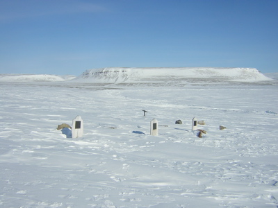
Acabo de devorar, si, esa es la palabra adecuada, el fascinante libro "Frozen Time" de Owen Beattie y John Geiger en apenas tres días. Y de su lectura vuelve a surgirme una cuestión que otras veces ya me había planteado (y que otros muchos se han planteado anteriormente), ¿Donde están enterrados los 8 oficiales y 13 hombres restantes que se mencionan en la nota del 25 de abril de 1848? ¿y Franklin?.
Un oficial y dos hombres fueron enterrados en la isla Beechey, pero ¿y el resto de aquellos que se mencionan en la nota? "...El total de pérdidas por muerte en la expedición ha sido hasta la fecha de 9 oficiales y 15 hombres". Puede que algunos murieran durante la travesía desde la isla de Beechey por el estrecho de Peel, en cuyo caso podrían haber sido arrojados al mar o enterrados en el hielo durante el invierno de 1846-47 cuando todavía se encontraban bastante al norte del cabo Félix.
Es muy posible que la gran mayoría de ellos muriera en el transcurso de los dos inviernos pasados en las proximidades de la tierra del rey Guillermo y durante la deriva de los barcos entre el punto donde quedaron atrapados en el invierno de 1847 hacia el punto en el cual fueron abandonados la primavera de 1848,.
Aunque no es probable que a muchos de ellos los enterraran en tierra firme, puesto que si trazamos una línea recta entre ambos puntos, la distancia más corta sería de unas 6 millas naúticas hacia la costa de la isla. Demasiada larga quizás para llevar a los cadáveres desde los barcos hasta la costa para ser enterrados. No obstante hay testimonios Inuit que aseguran que Franklin si fue enterrado en la Isla.
Frankilin murió en junio de1847, cuando posiblemente se encontraban en una posición relativamente más cercana al cabo Félix que la del invierno previo. Por ello es posible que aquellos que murieran a partir de ese verano y hasta el abandono de los barcos si fuesen enterrados en tierra firme, pero...¿donde? sus tumbas si existen, no han sido localizadas todavía, al igual que aquella de Franklin, supuestamente bajo una losa de cemento fabricado in situ y bajo un mástil con una bandera. Quizás se encuentren en una posición mas al norte de la tumba, supuestamente de Irving cerca del Punto Victoria.
Frankilin murió en junio de1847, cuando posiblemente se encontraban en una posición relativamente más cercana al cabo Félix que la del invierno previo. Por ello es posible que aquellos que murieran a partir de ese verano y hasta el abandono de los barcos si fuesen enterrados en tierra firme, pero...¿donde? sus tumbas si existen, no han sido localizadas todavía, al igual que aquella de Franklin, supuestamente bajo una losa de cemento fabricado in situ y bajo un mástil con una bandera. Quizás se encuentren en una posición mas al norte de la tumba, supuestamente de Irving cerca del Punto Victoria.
Leyendo el increible blog "Visions of the North" del Dr. Rusell Potter he localizado el Mapa de los restos y posible trayectoria de la expedición de Franklin en el 2009, fue dibujado por R.T Gould y que el encontró disponible en el año 2009 A COLOR en la Biblioteca y archivo de Canada. No hay rastro en este mapa que indique la posible presencia de estas supuestas tumbas perdidas.
I´ve just
devoured..., yes, that is the correct word, the fascinating book "Frozen
in time" by Owen Beattie and John Geiger in just three days. And
from its Reading
An officer and two
men were buried in the Beechey
Island
It´s possible that
some of them would die during the traverse from the Beechey
Island along the Peel Sound, in that case,
they might be thrown to the sea or buried into the ice during the 1846-47
winter, when they were still further north of Cape Felix
It´s very likely that most of them would die during the two winters passed close to the shores of
the King William Island and meanwhile the derive of the ships between the point
where they get trapped into the ice in the 1846-47 winter to the point in which they were
abandoned in the spring of 1848 (5 miles NNW the cairn).
Although is not
likely that they buried many of them in firm land. If we trace a straight line
between both points, the shortest distance to the shores of the island would be 6 nautical miles . Perhaps too far to carry the corpses from the ships to
the coastline to be buried. However, there are testimonies of the Inuit assuring Franklin was buried in the Island .
Because that, it ´s
possible that those who died from this summer to the moment in which the ships
were abandoned, would be buried on firm land . But, Where?.
Their graves, if
they exist, haven´t been located yet. The same occurs with Franklin grave
Reading the
incredible blog called "Visions
of the North" of the Dr. Russel Potter I ´ve located
the map of the relics and the likely trail of the Franklin Canada


No hay comentarios:
Publicar un comentario